
101 closed both ways south of Sylvandale exit
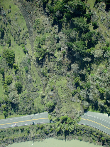
Aerial photo by Felix Omai, click on it to see it much larger. For other aerial photos by Felix click here.
For aerial photos from the California Highway Patrol click here.
More cool photos here by Kim Sallaway who hiked up the slide.
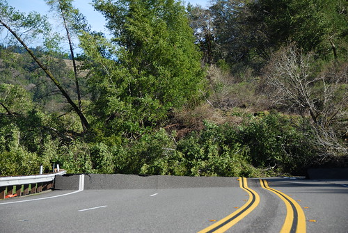
Photo by Cynthia Elkins, KMUD News. Click on the image for many more.
Tiny pictures from our station manager’s cell phone, larger ones are now in our flickr photostream:


Hank Sims has a list of options to get around the slide. None of them great…
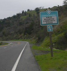
Hey, isn’t this the stretch of road KMUD’s been cleaning up for last couple of years? Simon says "sure hope we’re not responsible for this cleanup!"
From CHP Traffic Incident Information page:
11:16AM LT ENTRY, 1039 16-D4
10:57AM 1039 DOT
10:45AM 1039 ENTAC W INFO
10:39AM ROAD CLOSED SB AT SYLVANDALE AND NB AT REDWAY
10:39AM MINIMUM 2 WEEK CLOSURE
10:22AM AND NB IS CLOSED TAKING PEOPLE OFF NB AT DEAN CRK
10:22AM DOT HAS HARD CLOSURE SB 101 / DIVERTING AT SDALE
10:17AM PER CO RDS DYERVILLE & ALDPT RDS CANT HANDLE LG RIGS, INCLUDING SCHOOL BUSES
10:13AM 1039 SCHOOL DIST
10:01AM 1039 CO RDS, THEY HAVE SOME WORKERS ENRT TO ATT TO PLOW
10:01AM PER OFFDUTY B ANDERSON, LOCALS HEADING UP DYERVILLE LOOP & THERE S APPROX 1 FT OF SNOW
9:39AM 1039 ENTAC OFCR HEATH
9:37AM 1039 CDF
9:36AM 1039 HCSO
9:34AM 1039 S2, WILL BE ENRT
9:26AM 101 CLOSED BOTH WAYS
9:19AM MM 15*7, SLIDE COMING DOWN, CAL TRANS CLOSING RD, REQ CHP RESPOND
9:12AM 1039 CAL TRANS